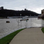
As rain drenched Southwestern Pennsylvania this week, Pittsburgh’s rivers reached their highest levels in nearly two decades.
The Pittsburgh area saw 72 hours of heavy precipitation, which dropped more rain over three days than the region had seen in all of March, Lee Hendricks, a meteorologist with the National Weather Service, said Friday.
Pittsburgh’s rivers crested at 28.8 feet early Thursday morning, exceeding the 28.5-foot threshold for the National Weather Service to consider it “major flooding,” Hendricks said.
The last time Pittsburgh saw “anywhere near” this level of river flooding was in January 2005, according to Hendricks.
National Weather Service data shows a 28.43-foot crest then. In September 2004, there was a 31-foot river crest.
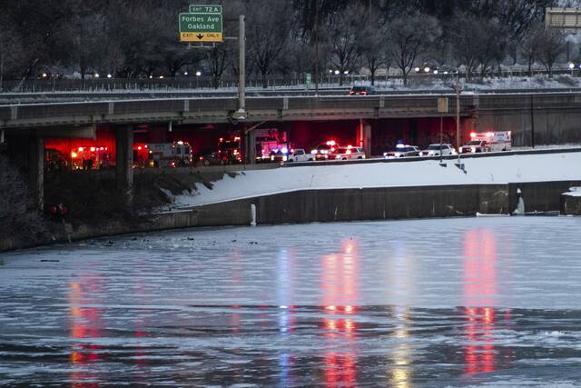
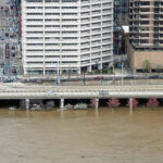
The flood-prone “bathtub” section of the Parkway East in Downtown Pittsburgh, which gets deluged at 25 feet, reopened Friday after being closed since Wednesday.
So did the 10th Street Bypass, PennDOT announced late Friday.
PennDOT crews pumped water and cleared mud and debris as flooding began to recede from the section of Interstate 376 between Grant Street and the Fort Pitt Bridge.
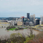
Point State Park also saw significant flooding. The Pennsylvania Department of Conservation and Natural Resources, which runs the park, posted on its website that the Allegheny and Mon wharves and the fountain plaza are closed until further notice.
The park hasn’t seen such extensive flooding since 2005, said Wesley Robinson, an agency spokesman.
Water crests the park’s lower wharves at 18 feet, he said, which has happened 101 times since 1936.
Robinson said park staff will assess damage as the water recedes, which they expect to happen Tuesday.
“With that much water, we expect a significant amount of debris cleanup to be needed in the next week,” Robinson said Friday.
Pittsburgh generally has seen fewer major floods in recent years, Hendricks said. That could be partly due to climate change, he said, and partly because of reservoirs that regulate how much water rushes into the area during heavy rainfall.
If the U.S. Army Corps of Engineers hadn’t controlled the amount of water coming through reservoirs during the most recent flooding, Hendricks said, Pittsburgh could’ve seen its rivers reach about 40 feet.
At that level, he said, PNC Park would be flooded, water would reach the floor of the Rivers Casino and the power station on Brunot Island in the Ohio River would be underwater.
River levels are slowing dropping to normal levels, Hendricks said, though they’ll remain slightly higher flow than normal until sometime next week.
Any additional rainfall the region sees Friday won’t be enough to have any impact on flooding.
PennDOT on Friday morning said the following Allegheny County roads also were closed or restricted because of flooding and landslides:
• Route 837 between the McKeesport Duquesne Bridge in Duquesne and McClure Street in Dravosburg
• Route 837 between New England Road in West Mifflin and Curry Hollow Road in Dravosburg
• Saxoburg Boulevard south of Berryhill Road in O’Hara
• Bunola River Road between River Hill Road and Elkhorn Road in Elizabeth Township
• Church Hollow Road between Raccoon Run Road and Elkhorn Road in Forward Township
• Ella Hollow Road between Guffey Road and Rainbow Run Road in Forward Township
• Walton Road between Dale Road and Riverview Road in Jefferson Hills
• University Boulevard at Stoops Ferry Road in Moon Township.