


Consider it an April Fool’s joke from Mother Nature. Just one that isn’t very funny.
A cold front moving through Southwestern Pennsylvania is expected to bring snow showers and cold temperatures on Thursday, the first day of April.
According to David Shallenberger, a meteorologist with the National Weather Service in Moon, a cold front will push through the region starting Wednesday night, causing temperatures to drop and rain showers to shift to snow.
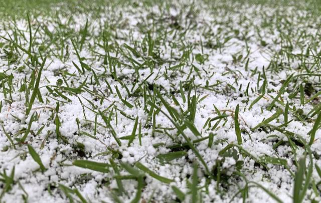
Allegheny and Westmoreland counties could get up to an inch of snow Thursday. The potential accumulation of snow increases to 2 inches for northern counties across the state.
Thought it was spring? April Fools! Tomorrow (April 1) will feel much like winter as highs will be in the 30s. We'll probably see some snowflakes too! ☃ Warmer weather then returns by the weekend. #PAwx pic.twitter.com/yydyYFaw2v
— NWS Pittsburgh (@NWSPittsburgh) March 31, 2021
This week’s roller coaster temperatures had a warm start in the 70s before dipping into the 50s Tuesday night and climbing near 60 degrees Wednesday.
By Wednesday night, the air will feel considerably cooler with the temperatures dropping to about 30 degrees, and rain could turn to snow.
It is 71 degrees at our office now and we are talking about snow....ya, I know...it's weird. However, the reality of the situation is we have a strong cold front advancing through our region Wednesday night into Thursday and some areas could see snow on the ground. pic.twitter.com/hYbofy6qJg
— NWS Pittsburgh (@NWSPittsburgh) March 30, 2021
It is not uncommon for the region to see snow in April, Shallenberger said.
“Anytime you get that northwest flow late season, you can get a quick accumulation, but it doesn’t stick around long,” he said.
Over a 30-year average from 1981 to 2010, Pittsburgh has received 1.5 inches of snow during April, according to NWS records. The latest, largest snowfall recorded during that period was in April 2005, when the area had 4.2 inches.
Since then, snowfall has largely been recorded as trace amounts, with accumulations reaching up to 1 inch at times.
The region saw a dusting of snow on April 10, 2020. The latest snowfall ever recorded in the region was a dusting on May 27, 1961, according to the NWS.
After Thursday’s cold temperatures, with a high in the mid-30s, “we’ll start to moderate slowly with highs on Friday getting into the mid-40s, and then we recover really well for the weekend,” Shallenberger said.
The high on Saturday is expected to reach the upper 50s, followed by the low 60s on Sunday.


