
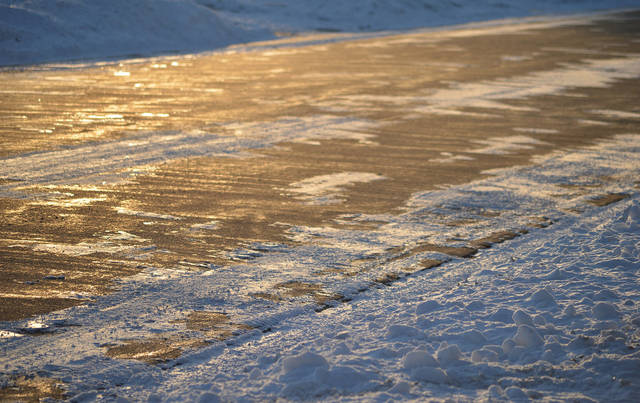
Almost an inch of snow fell across the Pittsburgh region overnight into Sunday morning, causing some slick road conditions, according to the National Weather Service.
“It was expected,” said NWS meteorologist Myranda Fullerton. “We anticipated snow basically last evening through the overnight hours. We had more snowfall north of Interstate 80 and in the ridges … down through Maryland and West Virginia where we had reports of 2 inches, give or take.”
Parts of Interstate 79 near Grove City started to accumulate snow around 9 p.m., NWS reported, and a lane of Route 28 near the Cheswick exit was closed Sunday morning due to a crash involving one vehicle, according to an Allegheny 911 dispatcher. No other issues were reported on the road due to weather, the dispatcher said.
Wrecks were reported across Westmoreland County Sunday morning. Manor Road in Export was closed between Wilson Road and William Penn Highway due to a vehicle into a light pole. One person was trapped in the vehicle, according to a Westmoreland 911 dispatcher.
In East Huntingdon, Ruffsdale Alverton Road was closed between Adams Bowser and Huffman Road after a vehicle overturned. One person was ejected from the vehicle and two people were trapped. Officials responded around 9:30 a.m.
Part of Route 711 in Ligonier Township was closed due to a multi-vehicle crash, according to the dispatcher. Between four and five vehicles were involved in the crash. No injuries were reported.
Most of Allegheny County was predicted to receive less than an inch of snow while parts of Westmoreland, including Latrobe, were expected to receive an inch. Areas of Butler and Indiana counties were expected to receive 2 inches, according to the National Weather Service.
A long wave trough is expected to return snow to our region late this evening. Snowfall totals above an inch will be mainly focused near I-80 and in the ridges. pic.twitter.com/JkXfUZhsYb
— NWS Pittsburgh (@NWSPittsburgh) February 1, 2020
Fullerton said officials did not expect a lot of snow to accumulate due to warm ground temperatures. She added that weather advisories are issued when snow is expected to accumulate to 3 inches.
Light snowfall was also expected Sunday morning, Fullerton said, adding that as a warm-front moves through snow will turn to rain. Temperatures should reach the mid-40s Sunday afternoon.
Temperatures will continue to rise Monday, with a high of 54 degrees. Rain showers are expected to move in Monday night, but a high of 56 is expected Tuesday.
Throughout January we've been asked 'Where's the snow?'
— NWS Pittsburgh (@NWSPittsburgh) February 1, 2020
The normal value for snowfall in Pittsburgh for the month of January is 11.8 inches; this January it was 4.2 inches. We haven't been this low on the snow for January since 1998 when we had only 1.7 inches.
January proved to be the lowest snowfall on record for the area since 1998, according to the National Weather Service. This year, just over 4 inches of snow were recorded compared to the normal average of almost 12 inches of snow for the Pittsburgh area in January. In 1998, only 1.7 inches were recorded.


