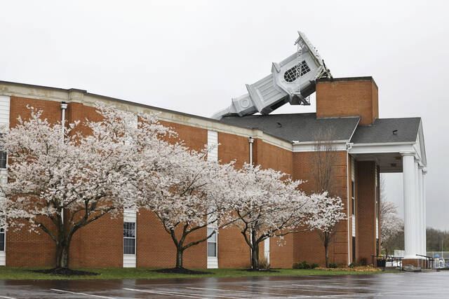
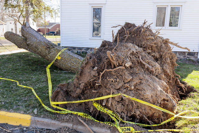
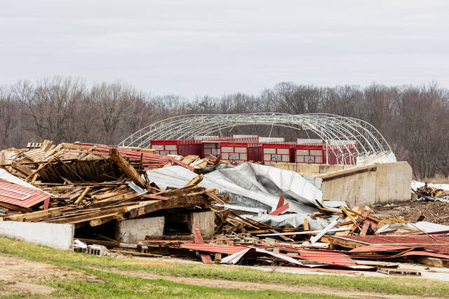
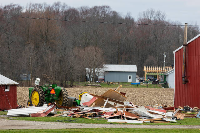
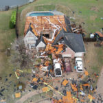
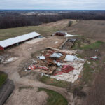

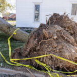


Tornadoes touched down in parts of the South and Midwest on Wednesday, knocking down power lines and trees and ripping roofs off of homes, while golf-ball sized hail fell in a region being hit by a violent swath of severe storms.
A tornado emergency was issued in northeast Arkansas, with the National Weather Service’s office in Memphis telling residents on the social platform X: “This is a life threatening situation. Seek shelter now.”
The South and Midwest also braced for potentially deadly flash flooding over coming days as severe thunderstorms blowing eastward become supercharged, forecasters warned.
Dozens of tornado and severe thunderstorm warnings were issued in parts of Arkansas, Illinois, Missouri and Mississippi as the swath of storms hit those and other states Wednesday evening. Forecasters expected the intense period of violent weather, with daytime heating combining with an unstable atmosphere, strong wind shear and abundant moisture streaming into the nation’s midsection from the Gulf.
Over a 300-mile stretch is under active tornado alerts as a dangerous outbreak unfolds. Here’s what we are tracking now: pic.twitter.com/EorDCJsxEv
— The Weather Channel (@weatherchannel) April 3, 2025
The potent storm system will bring “significant, life-threatening flash flooding” each day through Saturday, the National Weather Service said.
With more than a foot of rain possible over the next four days, the prolonged deluge “is an event that happens once in a generation to once in a lifetime,” the weather service said in one of its flood warnings. “Historic rainfall totals and impacts are possible.”
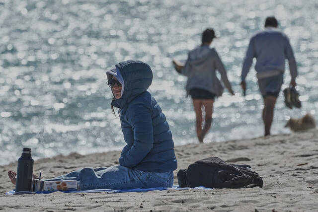
The flood fears come as residents in parts of Michigan continued to dig out from a weekend ice storm.
Floods could inundate towns, sweep cars away
Thunderstorms with multiple rounds of heavy rain were forecast in parts of Texas, the lower Mississippi Valley and the Ohio Valley beginning midweek and lasting through Saturday. Forecasters warned the storms could track over the same areas repeatedly, producing dangerous flash floods capable of sweeping cars away.
Here is graphic ????that depicts the timing of a potential squall line, currently over the Midwest, arriving in the Ohio River Valley over the next 6-10 hours.
— NWS Pittsburgh (@NWSPittsburgh) April 2, 2025
Make sure those emergency alerts are turned on while you are sleeping. pic.twitter.com/CJV3OYHGYp
Middle Tennessee was looking at severe storms followed by four days of heavy rain as the weather front stalls out and sticks around through the weekend, said National Weather Service meteorologist Mark Rose. “I don’t recall ever seeing one like this and I’ve been here 30 years,” Rose said. “It’s not moving.”
Rose said meteorologists are most worried about the Clarksville area. That area already was saturated with 170% of normal rain so far this year, he said.
Rain totaling up to 15 inches was forecast over the next seven days in northeastern Arkansas, the southeast corner of Missouri, western Kentucky and southern parts of Illinois and Indiana, the weather service warned, with some areas in Kentucky and Indiana at an especially high risk for flooding.
An EF1 tornado tore through Nevada, Missouri, today, ripping roofs off homes and leaving behind scenes of destruction. pic.twitter.com/R6swPui8ls
— AccuWeather (@accuweather) April 3, 2025
“We’re potentially looking at about two months of rain in just a handful of days,” Thomas Jones, a weather service meteorologist in Little Rock, Arkansas, said Monday.
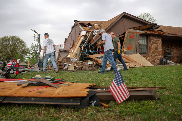
Tornadoes touch down and more could be coming
A tornado emergency was declared around Blytheville, Arkansas, Wednesday evening. This is the weather service’s highest alert and is rare but urges residents to seek immediate shelter. It was not immediately clear whether there were any injuries.
TORNADO SPOTTED near Bay, Arkansas.
— Action News 5 (@WMCActionNews5) April 2, 2025
(????: Garrett Hampton) pic.twitter.com/pACZCtQZpp
A tornado was also reported on the ground near Harrisburg, Arkansas, Wednesday evening, with the weather service telling residents on X to “be in your shelter NOW.”
Authorities in eastern Missouri were trying to determine whether it was a tornado that damaged buildings, overturned vehicles and tore down utility poles, tree limbs and business signs Wednesday morning in and around the city of Nevada.
Another tornado touched down in the northeastern Oklahoma city of Owasso about 6:40 a.m. Wednesday, according to the weather service office in Tulsa. There were no immediate reports of injuries, but the twister heavily damaged the roofs of homes and knocked down power lines, trees, fences and sheds.
High winds with gusts of up to 50 mph were expected across large parts of the Midwest. In Indiana, an extreme wind gust blew over five semitrucks on Interstate 65 near Lowell, state police reported. No one was hurt.
The ominous forecast comes nearly two years to the day that an EF-3 tornado struck Little Rock. No one was killed, but that twister caused major destruction to neighborhoods and businesses that are still being rebuilt today.
More than 90 million people are at some risk of severe weather in a huge part of the nation that stretches from Texas to Minnesota and Maine, according to the Oklahoma-based Storm Prediction Center.
Strong and long-lasting tornadoes appear likely in highest-risk area
About 2.5 million people are in a rarely-called “high-risk” zone. That area most at risk of catastrophic weather on Wednesday includes parts of west Tennessee including Memphis; northeast Arkansas; the southeast corner of Missouri; and parts of western Kentucky and southern Illinois.
The Storm Prediction Center said “multiple long-track EF3+ tornadoes” were likely. Tornadoes of that magnitude are among the strongest on the Enhanced Fujita scale, used to rate their intensity.
At a slightly lower risk for severe weather is an area that includes Chicago, Indianapolis, St. Louis, and Louisville, Kentucky. Dallas, Detroit, Milwaukee, and Nashville, Tennessee, were also at risk.
Wintry mix blasts Upper Midwest
In Michigan, crews worked to restore power after a weekend ice storm toppled trees and power poles. More than 128,000 customers in northern Michigan and 5,000 in northern Wisconsin were still without electricity, according to PowerOutage.us, which tracks outages nationwide.
Schools in several counties in Michigan’s the mitten-shaped Lower Peninsula were closed as deputies used chain saws to clear roads and drivers lined up at gas stations.
The Mackinac Bridge connecting Michigan’s Lower and Upper Peninsulas was shut down Wednesday because large chunks of ice were falling from cables and towers. It’s the third consecutive day of bridge interruptions from the ice storm.